


INTO THE ICE BOX PENGUINS...
- Jan 17
- 4 min read
I'M ASKING FOR YOUR ASSISTANCE...

Hi everyone, as you know TSwails.com is a no-pay site; existing on voluntary personal donations. Every year I ask those of you who find value in the site to make a financial donation you feel is worthy. Please reflect on the number of times you have visited us in the last year. If the information or knowledge you gained was valuable, it's my hope you will join the loyal group of contributors that's kept TSwails.com operational since 2013. I'm suggesting $20.00, which is roughly a nickel a day. Less than 4% of my readers donate, so your gift, no matter the size, is not only appreciated, it helps immensely.
INTO THE ICE BOX
A potent cold front zipped across the Midwest Friday opening the door to what promises to be a week of frosty weather. On top of the cold, spokes of energy rotating around a cold core upper air low will generate periods of light snow and flurries through the weekend. While accumulations won't be large, an inch or two of wind driven fluff will add injury to insult. Say hello to real January weather!
On the topic of snow, the initial volley Thursday night and Friday dropped a quick 1/2 inch to an inch. Some of my northern counties up around HWY 20 closed in on 2 inches. However, Friday's mild temperatures ahead of the polar front allowed highs to reach 36 to 41 which put a good dent in the snow cover and across the south wiped it out entirely.

Now the focus turns to the strong NW flow that delivers well below normal temperatures. In the GOES satellite imagery notice how the jet runs from the Eastern Pacific into the Gulf of Alaska. There it buckles around a massive upper air high pressure and turns abruptly southeast east of the Rockies. That's the recipe for Arctic air intrusions, and we will see several in coming days. Also, if you look closely you will see a spin in the clouds swirling into NW Iowa. That's a cold core upper air low that delivers the lift and vorticity to bring bouts of light snow or snow showers. One band will be moving through Saturday morning, with a second round arriving Sunday afternoon.

Between the EURO and GFS, 1 to 2 inches of new snow is indicated between Saturday and Sunday evening. The more substantial amounts should be north of I-80 north.
The EURO

The GFS

The HRRR and 3K NAM are a little further north with the forcing and about an inch lighter in most locations.
The HRRR

The 3k NAM

Most of the snow that falls this weekend should come with the 500mb low that both the EURO and GFS shows closed off at noon Saturday over SE Iowa. The best lift and vorticity occurs to its north which is why models are indicating the 1-2 inch snows north of I-80.

The second wave of snow which could accumulate an inch is tied to a clipper which rapidly powers southeast Sunday afternoon. It's starved for moisture but squeezes out what is available. The track of the system keeps the majority of the snow in the NE half of my area, especially N/NE of the Quad Cities.
Saturday will be a raw wintry day with temperatures in the teens and wind chills of 5 below north to 5 above south most of the day.
Enough warm air advection is found ahead of Sunday's clipper to allow temperatures in the far SW to reach the upper 20s. The NW won't be so fortunate with readings remaining in the upper teens. There will be enough of a breeze to keep wind chills in the single digits NE to the low 20s SW.
HOT DEALS INTO FEBRUARY....
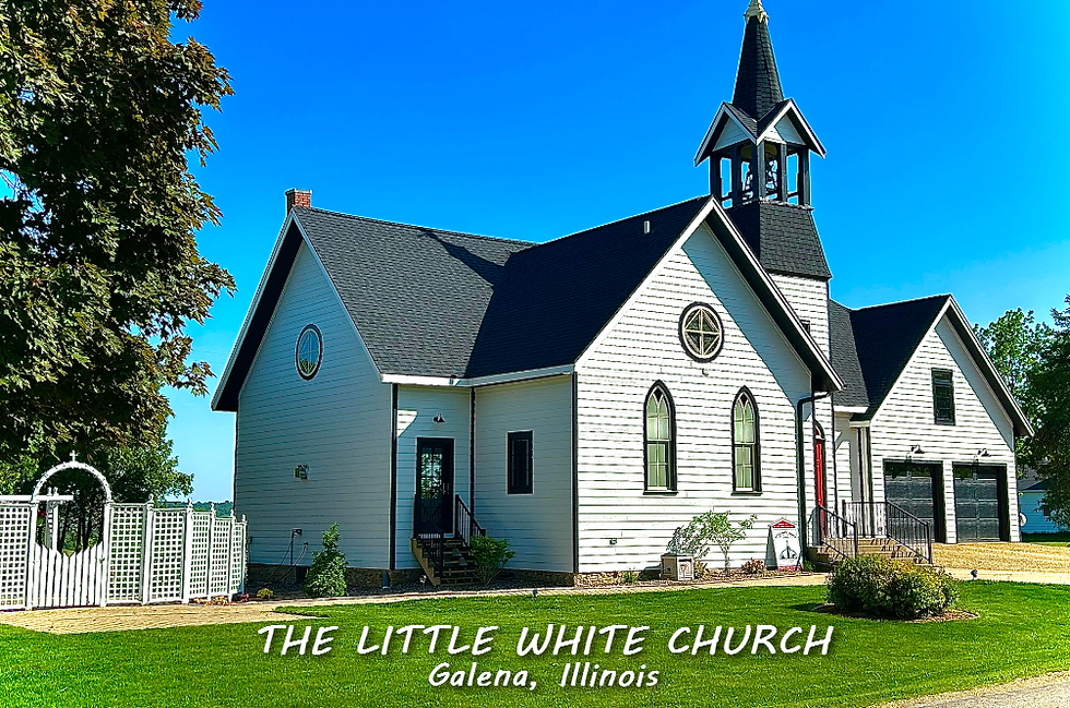
SNARE A WEEKEND, (4 GUESTS FOR $499 total) My AIRBNB outside of Galena is ready and waiting. Enjoy our unique, fully renovated church. It's an AIRBNB guest favorite with 5-star reviews. Warm and cozy, even in the winter. Minutes from Galena. Call or text Carolyn at 563-676-3320 for details about this very special deal. https://www.littlewhitechurchgalena.com/
BUNDLE UP BUDDY...
Sunday night behind the clipper, Arctic air surges southeast and strong NW winds make for a nasty night. Aside from the possibility of blowing snow in the NE, temperatures areawide will tank reaching lows below zero from the Quad Cities north, perhaps as cold as 7 below in spots.
Lows Monday

Bitter wind chills are expected Monday morning thanks to a stiff northwest wind. At the very least, an advisory for dangerous wind chills is a certainty. The far north will be pushing warning category. Decorah is shown at 31 below. I could live without that!

Temperatures remain in the teens Tuesday but make a recovery into the 20s next Wednesday ahead of the next Arctic surge which powers through Wednesday afternoon and Thursday. It could be accompanied by a bit of light snow but at this point an inch or less is what's indicated.
Just looking at the upper air pattern next Thursday, I have a concerned eye on that Polar Vortex situated north of Minnesota.

Just north of the U.S. border, 850 temperatures as cold as 36 below C are shown...that's roughly a mile up. That is some wickedly cold air and with the trajectory of the 500mb flow it would not take much to drive that south. Currently, we are shown locally around -21 C which is no picnic. My hope is that's as far south as the vortex gets because as it stands now that puts us well below zero for lows next weekend with highs not much above zero. A southward trend means even colder conditions. Fingers crossed for a warmer trend.

The way it looks now, the depth of the cold air is so deep that the baroclinic boundary is displaced so far south and the jet so northwesterly, that about the only potential for snow next week would come from any moisture starved fast moving clippers.
Between now and the end of the month the EURO ensembles (an average of 51 members) only shows this for snow.

The operational run, a single solution is distinctly more aggressive showing a stronger system around January 25th. Clearly the majority of the ensembles are not seeing that with their lower totals. Time will tell.

That's enough "GOOD" news for now. Put on your game face, we're headed for the trenches. Roll weather...TS


Comments