


IT'S SNOW JOKE....
- Apr 16, 2023
- 2 min read
It feels like a cruel joke... the grass is green, the birds are chirping, the trees are starting to come alive again... We just had four 80° days in a row in the are and now snow. In fact, there are Freeze Warnings and Winter Weather Advisories posted in the region:

On the backside of the storm that brought Saturday's storms there will be rain on the backside wrapping in on Sunday. Much colder air will be moving in as well.

There will be enough energy with this system to cool down the atmosphere significantly to lead to the changeover from rain to snow.

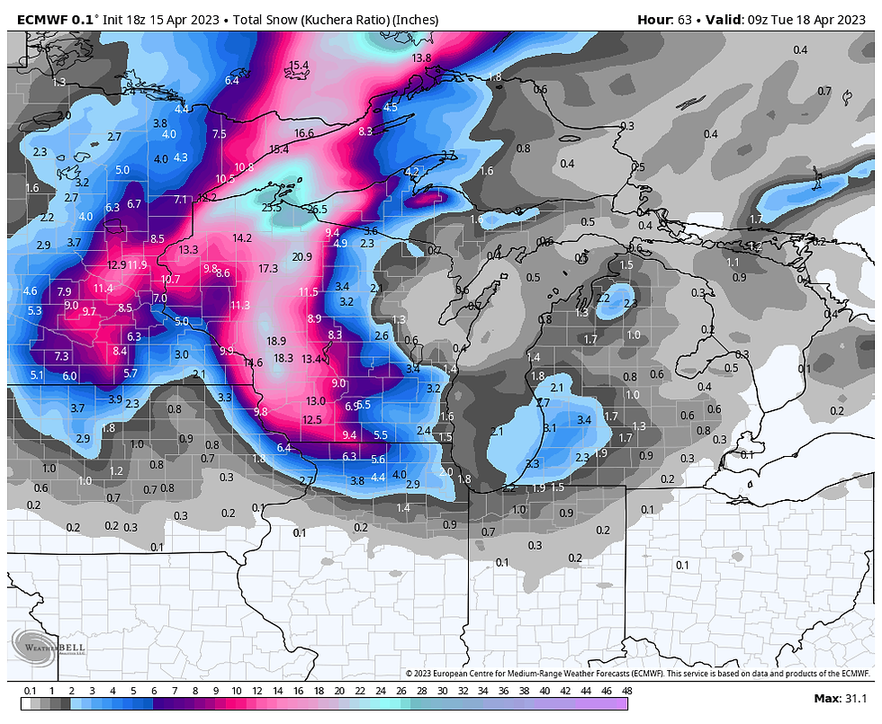
This is a process known as dynamic cooling and will be quite impressive, especially to see accumulating snow after a stretch of mild weather. There is a lot of uncertainty in the amounts and placement. Here is a look at the model output (not a forecast) to show the spread in POSSIBLE outcomes. I do think a lot of these numbers are way too high but concerning considering multiple models are showing it the large totals...
Here's a look at the GFS:

The European model:
The NAM:

And the HRRR:

This is the latest forecast from the National Weather Service (as of midnight Sunday):

With some of the latest data, I have some concerns for there being higher snowfall totals further west into Iowa.. we'll have to see how the situation evolves and where the heaviest bands set up. There may be some intense snow rates at times, especially to allow for accumulation.
We'll have to watch closely where this occurs because this will unfortunately be additional water falling on the Mississippi which is expected to rise in the next two weeks.. we'll talk more about that in my next post.
Stay warm!
Rebecca Kopelman


Comments