LOTS GOING ON BEHIND THE CURTAIN...
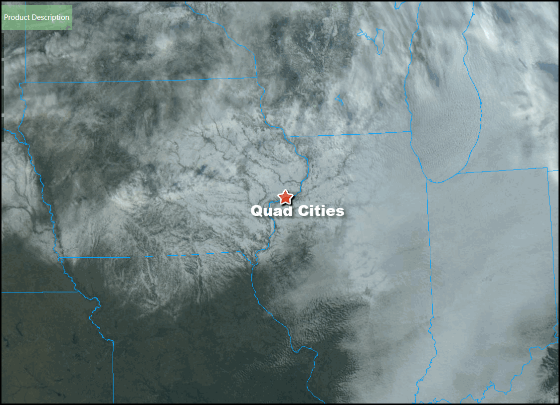
Yes ladies and gentlemen, that was the sun you saw in the skies around my area Monday afternoon. The rare sight was brought about by a drier a brisk SW wind that brought good mixing and drier air that finally broke the inversion that's prevailed the past week. Clouds are apparent in eastern Illinois but from there westward the white areas depict snow which remains on the ground. You can clearly see the river's and associated valley's cutting through the snow., especially over eastern Iowa.

Thanks to the sunshine temperatures reached the freezing mark over all of my area. The high reached 35 in Cedar Rapids. The last time it was warmer than that was December 23rd when the mercury soared to 55. Little change in the weather is expected now through Wednesday with partly sunny skies and slightly warmer readings as highs head for the range of 35-40 through Thursday. Where most of the snow melts in the far south (roughly HWY 34 and below) readings have a shot at hitting the mid 40s Thursday.

After that the pattern begins to transition to one that has the potential to bring colder and more active conditions to the Midwest the rest of January. The first system which initiates the process digs into the Midwest from the NW late Thursday. Look how that realigns the source region of the air over the Midwest. Here's the jet Tuesday afternoon at 500mb showing ridging and mild Pacific air.

The ridging of Tuesday is replaced by a strong trough and upper air low Friday.

That brings with it the chance of showers that would quickly change to snow showers or light snow Thursday night or early Friday. The overall track is not likely to bring significant amounts of precipitation but amounts of 1 to 2/10ths of an inch are pretty consistently shown. That leads to these snow totals.
The GFS

The EURO

The Canadian GEM

The precise placement of the upper air energy and its timing will be key to how much snow falls and where but an inch (maybe two is possible), especially in the northern half of my area. The Canadian solution looks overdone and suspect to me.
The disturbance will also bring gusty winds Thursday night and Friday that tug in significantly colder air for the coming weekend with highs in the 20s. The potential for Arctic air is still on the table in the 8-14 day period although models are still struggling to get a handle on just how cold and when. However, Monday's EURO ensembles produced teleconnections that strongly point towards a cold pattern. There is of course no assurance the EURO is correct but the signals shown below are the ones I would expect to see in a below normal temperature regime in January.
This is the projected EPO (Eastern Pacific Oscillation). Most of the winter this has been running positive but you can see at the end of the period it takes a very negative dive. That would indicate a building west coast ridge which is essential for the delivery of polar air masses.

The WPO (Western Pacific Oscillation) goes off the scale negative.

The Arctic oscillation remains negative reflecting blocking at high latitudes such as Canada and the north Pole, indicative of the evolving stratospheric warming.

The NAO which becomes a player this time of winter is also strongly negative, another cold signal.

The only big player that is not in a truly cold phase is the MJO. It's been meandering near the null phase which means it's essentially a non (or limiting) factor which should allow the other teleconnections to exert their will. Assuming the EURO is correct, which remains to be seen, I have good reason to believe there is a strong chance that at some point in the next 10-15 days a healthy shot of cold takes aim at the central U.S.
Here's the pattern that is largely associated with the negative EPO

On the right below is what's implied by the negative AO and NAO oscillations.

I guess I've made my case for cold long range, now it's up to mother nature to prove me right or the models to prove me wrong. Lot's going on behind the curtain. Meantime, Tuesday should be a pretty good day. Enjoy and roll weather...TS


