


SNOW ON THE MOVE, AN UPDATE
- Dec 6, 2025
- 2 min read
WINTER WEATHER ADVISORIES/WARNINGS IN EFFECT
Our second winter storm in a week is on the move, getting set to bring snow and more hazardous travel to the region tonight. Winter weather advisories go into effect at 6:00pm this evening and remain in effect until 6:00am. Sunday. Snow is expected to be the primary precipitation type, however areas south of I-80 may see some mixed precipitation that could lead to a light glaze of ice on roads in that area.

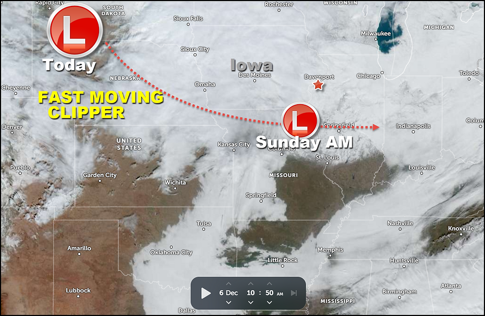
The center of the storm is currently situated over NW Nebraska on a track that will take it over NE Missouri by Sunday morning.
Snow has begun to break out over western Iowa that should reach my western counties by 7 to 8:00pm. this evening. It will overspread the rest of the region by 10 to 11:00pm from west to east.

The expected track will spread the heavier deformation band snows near and north of I-80 overnight.

Below you can see the official NWS snowfall forecast producing amounts of 2–5 inches from roughly I-80 north. A few spots between HWY 30 and HWY 20 could see up to 6 inches. Further south, amounts of 1–2 inches are anticipated from HWY 34 north to I-80 where some light freezing drizzle or mixed precipitation is found. South of HWY 34 snow amounts of an inch or less are expected with the threat of some glazing from freezing drizzle.

In general, models have come into pretty good agreement on snow potential. Here's what the raw model output looks like from the latest model runs Saturday morning.
The EURO

The GFS

The HRRR

The 3k NAM

The NBMv5 a blend of 30 models and ensembles.

The NBM blend of models

The 10K Canadian RDPS

The storm exists quickly Sunday morning and is followed by gusty winds that could produce some minor blowing and drifting in the open country. After highs early Sunday of 20 north to 28 south, steady or falling temperatures are likely the remainder of the day under strong cold air advection. That leads to a cold night Sunday night, with lows by Monday morning of -3 north to +3 south.
That's where things stand as of midday Sunday. Time to do some Christmas shopping. Until next time, roll weather...TS


Comments