


SPLISH SPLASH, GETTING A BATH
- Mar 31
- 4 min read
The first of multiple rain making systems paid a visit to parts of my area Monday night and early Tuesday, A nealy stationary boundary laid out along I-80 was the focus for showers and storms that brought some nice downpours to my central counties. Not only that, some one inch hail was noted in the stronger updrafts. The heavier rains set up mainly in an east west corridor that ran from south of the Quad Cities to the north of HWY 30. There was quite a bit of variance with amounts ranging from 1/10 of an inch to slightly over an inch.

My northern and southern counties didn't fair as well but from the looks of things, your time is coming with rain possible everday from now through Friday night.
After record highs in the low to mid 80s Monday, my northern counties were back around 70 Tuesday with the only 80s south of HWY 34 near Ft. Madison and Keokuk. Even there, readings were back in the upper 60s by late afternoon thanks to the passage of the cold front that sparked last nights rain.
That front is going to be the key to our local weather as it vascilates back and forth through Friday as waves of energy come and go. Wednesday, the front to our south begins to push north as a warm front, but it does not reach the Missouri border during the day. That implies a far from perfect day with abundant low couds and cool east winds. Also, warm air advection begins to develop in the afteroon. That could bring a shower or storm to the far south by evening. Here's what the EURO indicates for highs.

Wednesday night the warm front starts to make a move towards the area. Strong warm air advection and the addition of a potent level jet should fire showers and thunderstorms in earnest. Being north of the warm front, they would be elevated which should keep severe weather tied to hail, if there is any at all. With available water vapor nearing 1.40", that indicates abundant moisture to fuel beneficial rains. In fact, WPC shows a 5-15 percent chance of excessive rains of 1-2 inches.

Here's the surface map depiction tomorrow night showing a healthy rain band lifting north ahead of the warm front.

Rains are likely to diminish in the morning Thursday as we enter the warm sector behind the warm front. That is likely to send temperatures into the range of 68 to 75 from north to south.

With the triple point approaching the region in the afternoon, that should enable enough shear for scattered strong thunderstorms. The set-up is very contingent on heating and the postion of the warm front relative to my area.

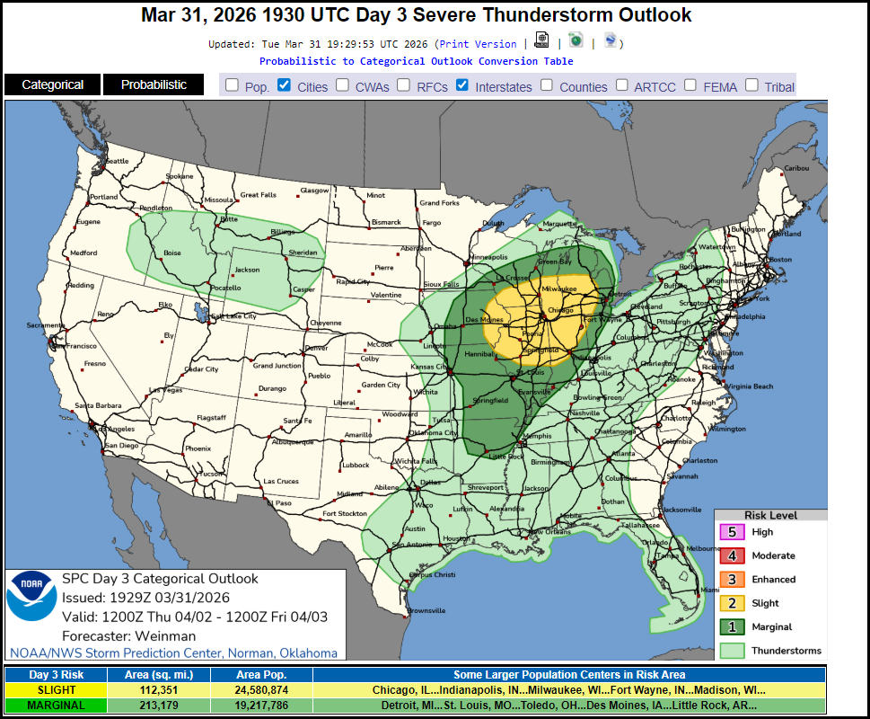
For now, SPC has all of my area in a slight risk outlook for severe thunderstorms.
Thursday night, the system drags a cold front through the region once again ending the threat of rain after the early evening hours. Right on its heels, a secondary low plows into Iowa Friday which pulls the front back north as a warm front and we get to do it all over again Friday. Here's the projected highs for Friday.

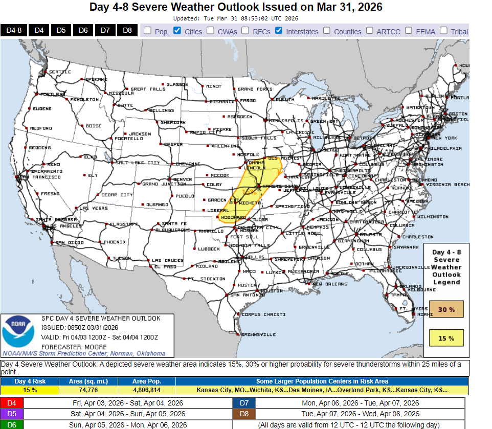
With another triple point set up and a warm front in the proximity, severe weather is back on the table. SPC is a little further SW with the set-up but that could easily change in the next update.
Lets talk some rain numbers. From late Wednesday through Friday night several periods of rain could dump some healthy amounts. One concern, with two potent lows tracking into Iowa is the dry slot. The hope is that neither of them goes directly overhead as that limits precipitation production near and under the low pressure track. Today's trends show a little bit less in the way of rain near and east of the Mississippi. Even so, amounts of 1-2 inches are widespread, with a few local spots shown at 3 inches.
The EURO

The GFS

The Rapid Refresh

The National Blend of Models
The Canadian RDPS

Once the final system blows by Friday night, cool but dry Canadian high pressure dominates Easter weekend. Saturday morning temperatures start in the low 50s to low 60s around daybreak. However, by mid-morning most spots have fallen back in the upper 40s to low 50s, which is where they will stay the remainder of the day, with a brisk wind. Easter itself looks a bit frisky with highs in the upper 40s to low 50s and a fresh NW breeze. The coat will come in handy this year. That's a wrap for now. Fingers crossed for the rain. Roll weather....TS
PS, I would also like to congratulate my climate and folklore specialist Steve Gottschalk on 42 years as a cooperative observer for the NWS out of Lowden, Iowa. That's thousands of observations which makes his data base one of the best in Iowa. Here's to another 8 years Steve! Set your sights in that 50 year threshold.


Microsoft Dynamics NAV is an ERP solution developed by Microsoft for small and mid-market companies (SMEs). The solution offers product functionality covering financial management, supply chain management, manufacturing, project management, and service management. Dynamics NAV is the former name of Dynamics 365 Business Central.
Microsoft Dynamics NAV belongs to the Microsoft Dynamics Navision Information Systems family. In 2013, a new generation of the world-famous Dynamics NAV Microsoft ERP was revealed to the world, and its fifth version is now available with Dynamics NAV 2018. This version of the Navision ERP system focuses on improving user productivity.
Microsoft NAV works on modern three-tier architecture. It provides heterogeneous access (Windows client, Web client and SharePoint client) to the application layer and database server, increases…