THE MARCH TOWARD CHANGE
- Nov 18, 2025
- 4 min read
A weather disturbance ejecting out of the southwest has brought showers to the region that will linger into Tuesday morning before tapering to drizzle and low clouds Tuesday afternoon. The dismal conditions will also be accompanied by chilly raw temperatures, which should range from 41 north to 46 north of I-80 to 46-51 south. Not one of our better efforts this fall.
The upper air disturbance is not especially strong (and in a weakening state), even so a nice wing of warm air advection will spread a light to moderate shield of rain ahead of the advancing lift. Here's the 500mb reflection entering western Iowa towards sunrise.

Monday night's satellite image shows the circulation at that time over Nebraska scooping up moisture ahead of it.

The bulk of the precipitation falls Monday night, when even some lightning and small hail is possible. Some light rain or showers is still indicated in the morning before it transitions to occasional drizzle. For the most part, accumulations are generally 1/3rd of an inch or less. However, some pockets of heavier amounts are possible in localized areas. Models are indicating totals that look like this.
The EURO

The 3K NAM

The HRRR

The GFS

One aspect of the storm we avoid is the wet snow that is expected to fall to our north. From the Minnesota border east into central Wisconsin, 1-3" of wet snow is possible in a narrowband. Here's where guidance shows the potential for some slushy amounts.
The EURO

The 3k NAM

The HRRR

The GFS

Forcing for precipitation is eliminated by Wednesday, but an inversion aloft and weak steering currents will see to it that low clouds and cool temperatures prevail, especially with the mid-November sun as weak as it is. Most highs will remain in the 40s, maybe 50 far south.
GIVE THE GIFT OF MY 5 STAR AIRBNB IN GALENA

Holiday and winter specials are now in effect through March. Let us help you set up a personalized gift certificate that's sure to create a lifetime of memories! Santa Claus approved. Call or text Carolyn at 563-676-3320 for details and our very best pricing. https://www.littlewhitechurchgalena.com/
BETTER DAYS AHEAD...
Several days ago, models had indicated a moisture laden system Thursday and Friday, again rolling in out of the southwest. However, little in the way of phasing is anticipated between the northern and southern branches of the jet. As a result, without the aid of a cold air conveyor, a weaker version of the storm will pass safely by to the south. At the very best, a few showers could graze my southern counties, but that prospect is growing more and more unlikely with each passing model run.
The impacts of this development will be that conditions this weekend should be relatively mild and precipitation free, with a fast W/NW flow aloft aborting moisture transport into the Midwest. Temperatures Thursday through Sunday should generally be in the 50s, well above normal.
The next rain chance does not appear to be until next Tuesday, and the main thrust of that may end up further west. A more substantial system is shown quickly following on both the EURO and GFS November 26th or 27th (Thanksgiving). This could very well be the storm that opens the door to the pattern change we have spoken about for more than a week that, at the very least, should feature much colder temperatures that increases chances for any passing storms to produce snow.
True to recent form, the EURO extended MJO continues to show the swing through phases 7 and eventually 8 about that time. The ensembles (the yellow squiggly lines) are also bullish, indicating a further advance into phase 1 to end December. All 3 phases (7, 8, and 1) correlate to below normal temperatures in December.

Anyway, if you notice above in the phase diagram, the entrance into the cold phases begins November 26th. Notice what happens to readings on the EURO deterministic model at that time. Down go the temperatures.

Christmas week, December 18th-25th, the EURO ensembles show this for average 7 day temperature departures.

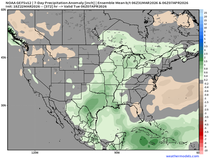
From late November through Christmas Day, the EURO extended mean shows this for snowfall. This is the mean of up to 100 solutions, so in the end, precise storm tracks will determine who gets what. However, as of today, this is the average solution of all the possibilities.

Meantime, I just saw a flash of lightning. Maybe that's a good omen. If nothing else, it's a sign that Monday night, 40 KTS of shear at rain making levels is enough to create the instability necessary for November thunder and lightning. I like it. That will do it for now. Roll weather...TS

TSWAILS.COM is now proud to offer expert weather consulting services, including:
Private consulting
Legal forensic services as an expert witness
Public speaking engagements for groups or individuals
Post storm analysis
A private day-long weather school class session
Specialized meteorological needs
Severe weather seminars
Call 563-676-3377 or email terryswails1@gmail.com


Comments