


THE RIDGE IS FIXIN' TO SHIFT
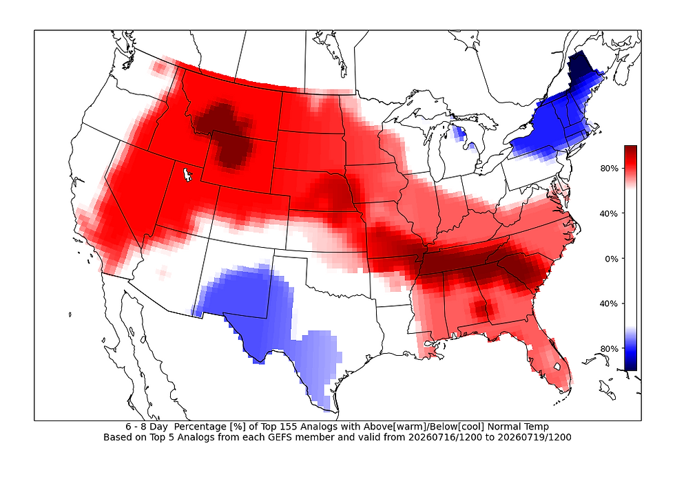
Short term the forecast is pretty straightforward. A Rex Block is in charge out to the west and it is locking the pattern down, however that pattern is projected to slowly break down as we head into next weekend. The overall ridge axis will likely slide to the west keeping the heat in place across much of the county. Locally we will likely see a slightly "cooler" trend by next weekend and someone more tolerable humidity levels as northwest flow brings in some drier air aloft.
Overall the pattern likely will keep rain and storm chances to a minimum, but if the upper air storm track is a little more overhead instead of closer to the Canadian border, we might see some slightly elevated storm chances by next weekend. Probabilities of that are rather limited.

Quad Cities temperature forecasts show the peak of the heat midweek this week with highs in the mid-90s and lows back into the low-70s. Next weekend into early next week the highs will likely drop a few degrees, and again this may come with some more comfortable humidity levels for July standards. Still quite high though!

The European Ensemble shows this gradual pattern breaking down through the week with the ridge pivoting more to the west by early next week. Overall I think the storm track based on this modeling is likely to the north of our area, but that northwest flow this time of year isn't anything to be entirely bliss of. Ridge riders can quickly develop and change a forecast.

Analogs July 16-19 are indicating a slight chance for severe weather with that development of northwest flow. Friday and Saturday may be the days to watch for some potential action, but confidence is quite low overall in this solution coming to fruition. We'll call it a watch item as the overall forecast is otherwise quite benign with not much to discuss.

Officially the forecast from the Climate Prediction Center shows near to below normal chances of precpitation in our area. I think this is pretty spot on as any ridge riders (storms along the upper air storm track on the northern edge of the warmest temperatures) would be most likely in eastern Iowa to northern Illinois. Notice how the severe analogs image and the near-normal sections of the two charts above have a lot of overalap. Confidence is low, but I think it's a rather legitimate watch item.

Officially we have seen some Moderate Drought develop in western and northern Iowa but most of the area is still benefitting from heavy rainfall over the last month and a half. We will need some rain chances to keep this in check, which for now, is dependent on low-confidence storms next weekend.
Have a great Sunday and stay cool, friends!
-Meteorologist Nick Stewart


Whether you are a fan of racing games or just looking for a fun browser game to enjoy during a short break, Drift Boss offers an exciting drifting experience that is easy to learn and difficult to master.