


UPDATE ON SNOW TONIGHT
- Jan 20
- 2 min read
I'M ASKING FOR YOUR ASSISTANCE...

Hi everyone, as you know, TSwails.com is a no-pay site; existing on voluntary personal donations. Every year I ask those of you who find value in the site to make a financial donation you feel is worthy. Please reflect on the number of times you have visited us in the last year. If the information or knowledge you gained was valuable, it's my hope you will join the loyal group of contributors that's kept TSwails.com operational since 2013. I'm suggesting $20.00, which is roughly a nickel a day. Less than 4% of my readers donate, so your gift, no matter the size, is not only appreciated, it helps immensely.
PLEASE CLICK HERE TO ASSIST
A CLIPPER CLIPS THE NORTH
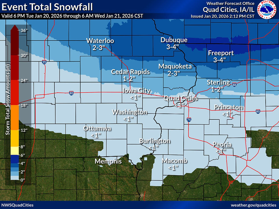
A fast moving clipper will bring accumulating snow to my northern counties overnight. A wing of warm advection should develop the snow band early in the evening. Due to the path of the clipper, saturation is not likely south of I-80 and little if any snow is expected there. In fact, the majority of the accumulating snow will occur north of HWY 30 with the largest amounts (1-2 inches) expected near the HWY 20 corridor. A few local spots could approach 3". A Winter Weather Advisory is in effect from 6:00pm through the night for slick travel conditions.

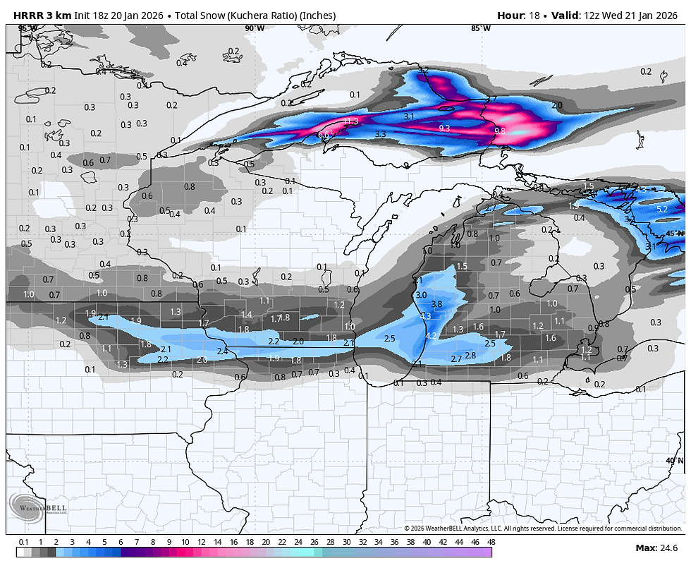
Moisture content is not great but cold temperatures will allow for high snow rations that will fluff up nicely. Most of the accumulations will occur in a 6-hour window and snow will end in the north from west to east after midnight. Here's what models are suggesting for accumulations. This is what is known as raw model output that varies some from model to model.
The EURO

The GFS

The 3k NAM

The HRRR
The Canadian 10k RDPS.

The official NWS forecast looks like this, but I think based on the latest data it is too heavy and a bit too far south. I would closely align with the HRRR and 3k NAM outputs above.
After the snow another light clipper may produce some additional snow showers in the north Wednesday evening. That should not amount to much, generally less than an inch and again confined to the northern third of the area.
Behind it, Arctic air will bring bitter cold for the end of the week, with very harsh wind chills. More on that in my next post.


Comments