COOL IS THE NEW RULE...
- Aug 2, 2017
- 2 min read

We're in the heart of the dog days but starting this weekend you won't hear much barking. The hazy, hot humid conditions this time of year is famous for will be nowhere to be found.
The leading indicator in this transition to cool is the MJO or Madden Julian Oscillation. A mass of energy traversing the tropical Pacific is set to buckle the jet and open the floodgates to fresh Canadian air. This coincides with the MJO entering (and slowly traversing) phase 6 the next 2 weeks. You can see the progression by following the dotted green line. Note below how phase 6 has a strong correlation to cooler than normal readings over the Midwest during August.

Here's the buckle in the 500mb jet stream flow that brings the cool air into the Midwest starting Friday. Quite a trough for this time of year.

The proof is in the pudding and here's the day 1-5 temperature departures from the CFSv2

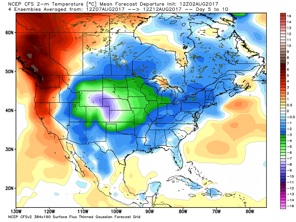
Now the day 5-10 departures

The GEFS looks pretty much the same for both periods. Here's day 1-5

Now the day 5-10 departures.

One of the days with the potential to be the coolest is Sunday. The GFS rolls a wave across Iowa that produces plenty of clouds and some showers. It may be a bit aggressive with this solution but it has been consistent.

It keeps highs in the 60s over much of the Midwest including my area.

Readings in the 60s are 20-25 degrees below normal. Weird!

One last thing to touch on is the potential for strong storms Thursday afternoon or evening along the advancing cold front. Illinois and Wisconsin appear to be the best candidates for this but it will be heavily contingent on how much instability is attained. As it stands now the Storm Prediction Center has this area outlooked for the potential of severe weather.

Whatever happens, after Thursday cool is the new rule! Roll weather...TS


Comments