SWITCH TO SPRING!
We've flipped the switch to spring! Although Friday morning started off with record lows in portions of the Midwest.

Additionally the low in Moline was 24 degrees which beat the previous record of 25 set in 1983. And it has overall been a very cold start to April.

Dubuque has had the coldest 18 days of April on record! But now it's starting to warm up and on Friday temperatures got above freezing and snow melted away in the Midwest. You can still see the snowpack though in northern Iowa and southern Minnesota.

The snowpack is decreasing though! This is a high resolution satellite showing the snowpack melting from Thursday to Friday -

And more of the snow will melt as the warmth continues into the weekend. Saturday's highs -

Sunday's highs -

And the weather is going to remain pretty calm. There will be clouds Saturday across much of the Midwest with rain in Kansas, Nebraska and Missouri. More sunshine on Sunday.
The weather will be fairly dry through the start of the week too. Here's the precipitation forecast through Tuesday.

Overall temperatures will remain near normal through the end of the month (there may be some dips here and there). By and large we have flipped the switch to spring!

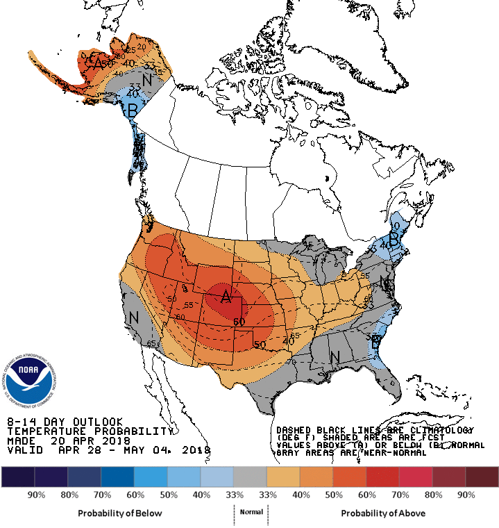
And the Climate Prediction Center has near to above normal temperatures in the Midwest as we head into the beginning of May.
Not much else to say! RK


