NOT MUCH HAPPENING HERE...
After an incredibly active start to September in the Midwest things are calming down. It's been a cool and comfortable weekend with temperatures in the 70s and low humidity.

Dry air has moved in after tropical moisture was in overhead for days. Here's a look at the precipitable water (PWATS) values Sunday evening.

The PWATS of two inches is continuing to push east and we will be staying dry. High pressure is going to be in control and this week is going to be very calm this week.

The reason why it will be calm is because the tropics are incredibly active. The climatological peak of hurricane season in September 10th, so this isn't unusual.

Unfortunately, Hurricane Florence is expected to strengthen and make landfall somewhere along the southeastern coast of the U.S.

There is still a lot of time for preparations along the coast of the Carolinas/Virginia as there will be strong winds, high storm surge, and heavy rain. With this strong storm going to the east coast there there will be a ridge (high pressure) sitting in overhead.

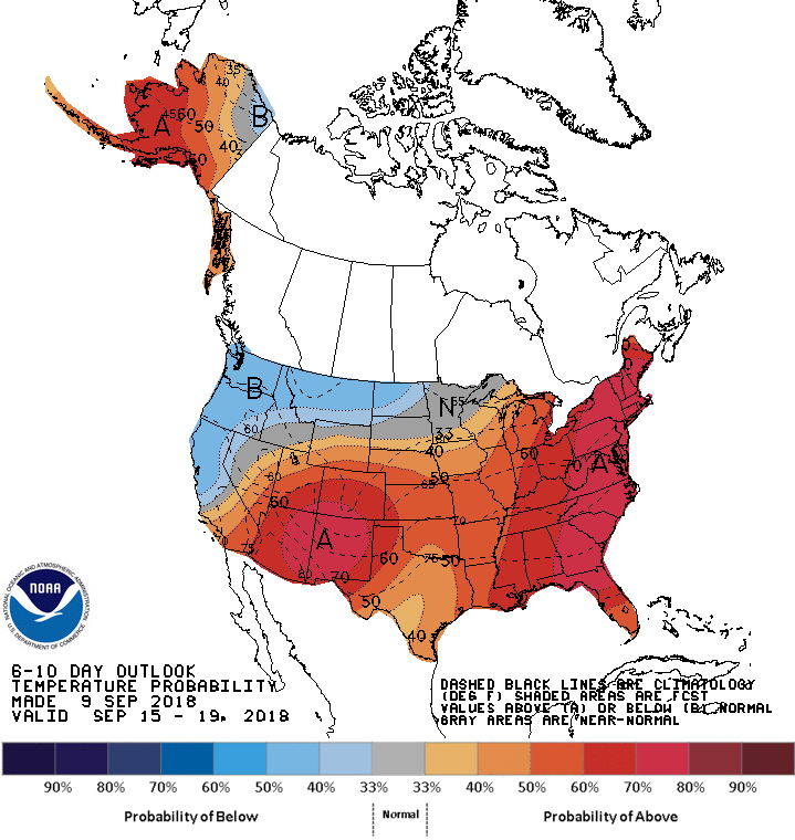
Other than it being calm, temperatures will gradually warm through the week and most of the country will be experiencing near and above normal temperatures.

This will allow the river levels to drop and everybody to dry out after the heavy rain in the Midwest over the last week.
RK


