THE DOORS OF WINTER SHOULD OPEN WIDE....
With the MJO (Madden Julien Oscillation) cycling into mild phases the evidence remains strong that overall temperatures will be near to above normal much of the next 2 to perhaps 3 weeks.

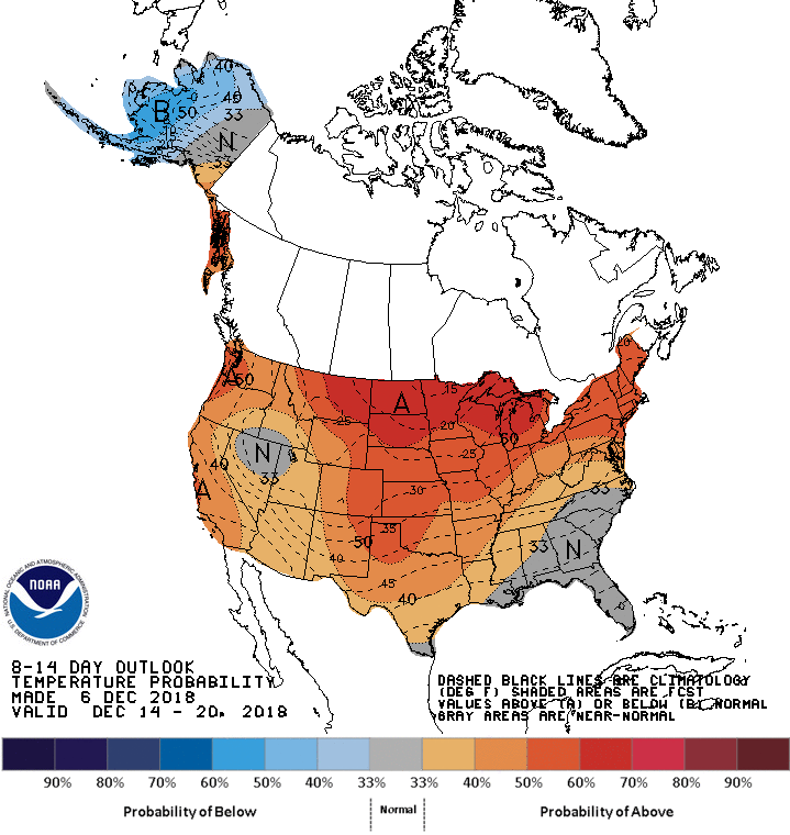
Norms are now in the low to mid 30s and steadily falling, so when I say warmer than normal I'm generally talking a range on high temperatures of 35 to 40, maybe as much as 45 degrees. That's no blow torch but certainly better than the colder equivalent of 20-30. The 8-14 day temperature outlook from the Weather Prediction Center looks like this.

It's my belief that what we're seeing during the upcoming period is nature reloading for what should still be a formidable winter ahead. It's rare for cold to just lock in and run the entire length of winter, especially when it starts as early as it did this year. I think this is nothing more than a breather. Certainly the models are pointing that direction.
The new seasonal outlooks from the EURO are available and the message is still the same for winter, ridge west coast, trough central and east. Below you can see that configuration in the recently released mean jet stream pattern for December through February. That's a cold look.

A closer view shows the expansive area if above normal heights over NW Canada. That implies extensive high pressure which points to a large reservoir of cold air that can travel unimpeded into the mean trough over the eastern 2/3rds of the nation.

The individual monthly forecasts of the EURO are quite persistent in keeping that cold ridge locked in place out west much of the winter.
December

January

February

Joe D'Aleo of Weatherbell has developed his own long range model and its performed very well the past few years, especially at 500mb. Here's what his model indicates for mean 500mb heights December-February. Quite similar to the EURO.

This is the associated temperature departures.

The Jamstec model which puts a heavy emphasis on inputs from El Nino and the Indian Ocean Dipole has this for winter temperatures.

Even the CFSv2 which has been ridiculously warm and out of touch with the other major models came in cold today. It showed this for January temperatures. That's a big change from where it had been.

Needless to say there is overwhelming evidence that we've got a lot of cold on the table once it decides to cut loose. So far no obvious signs of that happening but I have my eyes on late December or early January for the doors of winter to open wide. Stand by! Roll weather...TS


