MORE RAIN ON THE WAY....
- rebeccakopelman
- Mar 10, 2019
- 1 min read
The new week will start off quiet, but a strong storm will move through the Midwest midweek. Mild temperatures and heavy rain will increase the potential for flooding on some rivers and streams. First of all, a half an inch to nearly two inches of rain fell Saturday in Iowa and Illinois.

This first batch of rain has led to some rises already with ice jams happening on a few rivers. Right now there are several Flood Watches and Warnings on rivers.

Monday will be dry and temperatures will be near and above freezing across the Upper Midwest.

Tuesday will be even warmer, which will promote more melting snow, and it will be dry until the evening.

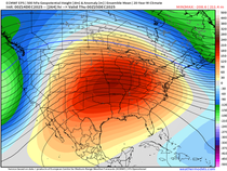
Then this storm will pump even more warm air in on Wednesday as the storm rolls through. This will likely be the warmest day of the year (so far, of course) for many.

Here's the latest track of the storm on the GFS - mind you this will likely still change some in the coming days.

Showers and even thunderstorms will produce heavy rain Tuesday night through Thursday. Here's the latest precipitation outlook from the GFS:

And European:

This additional rain and melting of the snow around Iowa and Illinois will likely lead to more ice jams and rises on rivers. We'll get a better picture over the next 24 hours or so.
The long game will be watching the immense snowpack up to the north. It will still be a while before all of this melts away:

The melting of that snowpack will be the focus for the flooding potential in the spring.
RK


Comments