A FLOOD FOR THE AGES...
- Brandon Marshall
- Mar 20, 2019
- 3 min read
Severe and historic flooding has left nothing but devastation across Nebraska and western Iowa. Flood waters have swept away homes, roads, bridges and turned some communities into virtual islands with no way in or out.
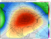
Heavy rain falling on several inches of snow along with warm temperatures was all it took to set the flood waters in motion. A week ago, on March 13, a massive cyclone and deepening low pressure system developed as it crossed the Rockies. The central pressure of the storm was measured at 970.4 millibars (28.65 inches of mercury) in Lamar, Colorado which set a state record for lowest pressure recorded. The image below is from NOAA's Weather Prediction Center and shows the expansive nature of the system.

It brought blizzard conditions to the northern plains with several inches of snow that laid out from northwest Nebraska to northern Minnesota. Hurricane force winds were measured at the Colorado Springs Airport with a gust of 97 mph. The storm was able to draw plumes of moisture from the Gulf of Mexico which dumped heavy rain from Texas north to Missouri, eastern Nebraska and western Iowa.
Like many locations in eastern Iowa, parts of Nebraska were coming off of an extremely wet fall so the soils were very saturated heading into winter. After a snowy and cold February, the ground was like a frozen tundra. The rain combined with warmer temperatures was enough to rapidly melt the snow. The water equivalent in the snow ranged from 2-4" or more and it was unable to absorb into the frozen ground which ultimately resulted in runoff. The rivers already running high could not take on any more. They clogged with ice and as additional water poured in, the rivers eventually overflowed their banks.
The picture below is from NASA Satellites twitter page and shows the snow cover two days before the storm, and then three days after as the snow melted and rivers swelled.

Another picture from the National Weather Service in Omaha shows the before (bottom) and after (top).

The NWS Omaha office is located ~30 miles west of the city in Valley, Nebraska. It sits literally feet away from the Platte River which suffered a levee breach last weekend. Flood waters spilled into the community displacing many residents including everyone at the weather service. Below is a picture of their office taken by an employee of the Papio-Missouri River Natural Resources District and shows the flood waters that inundated the office.

The amazing meteorologists and forecasters are still serving their communities and providing critical weather and flood information as they are operating out of the office in Hastings, Nebraska until the flood waters recede and they are able to resume their capabilities back in Valley.
Flood waters and large chunks of ice like in the picture below have wiped out roads and bridges causing severe damage.


According to the Nebraska DOT, over 1500 miles of roads were closed at the height of the flood. Today that number is less than 500. The Nebraska Emergency Management Agency lists 74 counties, 88 cities and 4 tribal areas having declared an emergency. As a whole, affecting 1,735, 635 (95%) of the states population and 59,088 (76.39%) square miles.
An ~140 mile stretch of I-29 from Council Bluffs, IA to St. Joseph, MO is closed due to flood waters. You can see why below.

Below is a tweet from the Iowa State Patrol as an officer attempts to drive a stretch of I-29 near Council Bluffs. Although flood waters have receded a bit, debris still litters the road.
The Missouri River experienced record flooding as it rose 30'-40' in some spots spilling over its banks and completely submerging farmland and communities. Although it has receded since it still remains in moderate to major flood stage.
It's going to be a long road to recovery for many people in the region. Damages have already reached $1.3 billion with hundreds of livestock lost. If you'd like to help those affected you can find more information here. We're all praying and hoping for a speedy and safe recovery.


Comments