SNOW ON THE MODELS...ALSO MANY THANKS!
- terryswails1
- Oct 3, 2019
- 4 min read
Before I get to the fun stuff wintry weather on the table, I wanted to thank the generous (and kind-hearted) people who made subscription donations to TSwails.com. As many of you know I requested a voluntary yearly fee of $12 dollars ($1 dollar per month) for my services and expenses now that I'm no longer working in TV. At last check, nearly 100 of you made the financial commitment to keep the site up and running...and boy we sure appreciate that! You guys are rock stars. TSwails is now like public television. It is supported by donations. So if you feel you have received good service and great information, please feel free to plunk down 12 bucks. If not, just keep enjoying the site. But if you love what we do...you want to help ...then please click on the green box in the secure site below. It has nothing to do with Facebook, it's an entirely independent funding page. Thanks much for anything you can do!
Let's talk some weather. Earlier today I got this question on Facebook, are you looking at blizzard like conditions for Illinois and Iowa around the 10th.

How fast the social media works! The GFS in both the 12 and 18z runs started showing a decent snow system around the 11th for parts of the Midwest. Despite what the model is depicting, beyond a week away and coming in early October, the chances of this happening are slim and none, especially this far south. This would be one of those "perfect storm" set-ups where a rare bunch of factors would have to come together just right. A blizzard is even more extreme. A system of this magnitude would break records for all-time early snows.
Back in the stone age, before the internet, social media, and public availability to models, few would have any inkling such a scenario existed. However today, a person puts it out there and in a few minutes hundreds could conceivably hear that "white death" was on the way. Get to the store and buy your supplies!
Anyway, now that it's out there among the masses that snow could be lurking, I'm forced to address the situation. Let's start with the GFS and what it showed to get everybody fired up. First the snow totals from the morning 12z run. Both regional and Iowa based perspectives.


Now the afternoon 18z GFS run showing the regional and Iowa snow perspectives.


You got to admit it looks pretty impressive. Even though its chances of happening are next to zero, I'm just thrilled to even be looking at this on October 3rd. Good for me to see snow back on the models.
Throwing even more cold water on this scenario happening is the EURO. It keeps most of the precipitation rain. However, at the tail end it does produce some minimal totals from Nebraska into parts of Iowa and SE Minnesota.

The EURO EPS ensemble control is intriguing but snow free in my area. Its 51 members come up with amounts that look like this. Considering October climatology this solution is more plausible to me. The track is further NW and the totals much lower. Experience tells me cold air has a hard time holding over the central Midwest when early season storms spin up. That favors a track through Iowa and southeast Minnesota eliminating the threat of snow here.

I'll also throw in the GFS ensemble (GEFS) . Notice it looks much different than the operational GFS and has a resemblance (albeit weaker) to the EURO ensembles.

So what we have here is good agreement in the EURO, the EURO ensemble, and the GEFS ensembles that any snow is well to the NW. The GFS operational which is the most bullish for snow is the odd man out. My gut tells me the GFS is the least likely solution and we might as well throw it out.
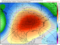
Having said all this, the pattern does appear ripe for a much colder look starting about October 10th. The MJO looks to be moving out of phase 1 and that is a key teleconnection to keep and eye on. Also, the JMA (Japan Meteorological Society) shows the eastern ridge getting squashed with positive heights over Greenland. That blocking resembles a negative NAO (North Atlantic Oscillation). That would aid to drive cold air into the center of the nation.

The GFS has this for 5 day temperature departures the 11th-16th

The GEFS ensemble for the same period.

Here's the EURO's departures for that same stretch.

This atmospheric re-alignment would also bring a strong chance of frost and freezing temperatures to much of the Midwest. Just to recap, it appears summer is quickly fading. A change to colder weather is on the horizon in just over a week. Some parts of the Midwest could see some wet snow around the 11th but I doubt we'll see it in my area. If the trends hold, a frost or freeze looks likely in the period encompassing the 12-15th. Certainly some things to keep me occupied in the coming days. Roll weather and remember to subscribe if you can swing it...TS


Comments