RECORDS DESTROYED OVERNIGHT...
- Nov 12, 2019
- 2 min read
Last night under fair skies, diminishing winds, a snow pack, and a frigid early season air mass, temperatures crashed to record levels around the Midwest. At last report 127 stations had broken record lows around the central U.S. Here's a sampling of cities that either had records or were within 3 degrees.

In Cedar Rapids, our low of 6 below broke ( make that shattered ) the old record of 5 set in 1986. Here's some of the lows in my area.

More lows for Iowa

More for Illinois

These are what temperatures looked like at 7:00am

Here are the lowest wind chill values reported in Iowa. 24 below in Clinton and -20 here in Cedar Rapids. That my friends is incredible!

The 6 below in Cedar Rapids is the coldest temperature ever for so early in the season. The previous record for a reading of 6 below or colder was November 17, 1959,

The next issue is what to do with the snow system for late Wednesday and Wednesday night. Still big differences with the EURO and the U.S. based models. One thing that is for sure is there isn't much moisture for the system to work with. The PWAT (precipitable water vapor) at Davenport this morning was .08", an all-time record low for the date. In other words the Arctic air is dry as a bone.
As it stands now, the EURO is the only model which does not show a well defined secondary band of snow cutting through the northern half of my area Wednesday evening. The EURO is apparently initiating data differently into its output. What this means is that it has the right idea or its going to bust. As you know I'm a big EURO fan, especially this close to the event. I am leaning towards its idea of a dusting south of HWY 20 down to about I-80. North of HWY 20, especially north of HWY 18 in NE Iowa and points north, 1-2 totals are possible.
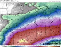
At this point this is a low confidence snow forecast and I'm curious to see later today if we get movement by the models to more of a consensus solution with that second southern band of snow. I'll have that for you later today. Meantime here are the different model depictions of snowfall.
The GFS

The 3k NAM

The CANADIAN

The EURO

More for you on the snowfall discrepancy later today. Roll weather...TS
PLEASE CONSIDER THE VALUE...
I hope you are aware of how far ahead of the competition TSwails has been in catching the trends of our early winter weather pattern. It takes a heck of a lot of commitment, passion, and knowledge to do that. This is now my job and that's why I'm asking for a voluntary subscription fee of $12 dollars a year, one dollar a month to keep TSwails going. Together we can create one of the best, most unique, and reliable weather sites in the Midwest. Your contribution of 3 cents a day, allows me to stay free of the corporate world and pour my energy into doing what I do best, forecasting the weather! We hope you see the value and hard work that goes into the site everyday. You support in any way is sincerely appreciated. Thanks and roll weather. To donate click on the secure green box below.


Comments