


SPLASH AND DASH STORMS, WITH A SIDE OF HUMIDITY...
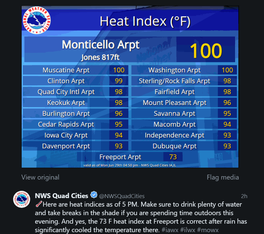
Make no mistake about, Monday was a burner. With highs in the range of 85 to 90 and dew points in the 70s, it felt more like 95 to 100. That qualifies it as a dog day of summer. Here are some late day heat index values from the NWS in the Quad Cities.
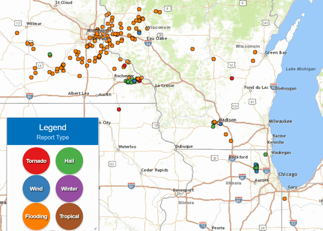
With that much heat and humidity, instability was high but forcing was lacking and most of the thunderstorms avoided my local area. That was not the case where intense thunderstorms battered parts of the upper Midwest. Rainfall amounts were excessive in a band that caught Minneapolis and extended into NW Wisconsin where 4-9" totals were measured.

You can see all the reports of flooding in that part of the Midwest.
Going forward available water vapor will remain at high levels closing in on 2.00" in many spots Tuesday afternoon.

That locks dew points in the 70s and with highs well into the 80s, plenty of instability will be present as evidenced by these CAPE values.

The question then becomes do thunderstorms develop? Overall, the best forcing for storms should remain split, north or south of my area. However, the tropical environment means just about any location could see a thunderstorm, especially during afternoon heating. However, the lack of organized forcing and a synoptic front should keep the storms spotty. The southern third of my area (south of I-80) seems to have the greatest chances with 30-50 percent coverage. The further north you go the better chances of a dry day. With the high moisture levels any storm that does fire is capable of dumping an inch of rain in a short period of time. Bottom line, there will be lots of dry hours and many of you will see no rain at all. Not much I can do but broad brush the threat focusing on the south..
Tuesday night and Wednesday looks like more of the same with somewhat better forcing. Storms should be a bit more numerous, especially in the west and south. Again, any area that gets a decent updraft is going to get a good downpour. The EURO shows this for total rain into Thursday morning

The GFS for the same period.

The 3k NAM

By Thursday only minimal rain chances remain with any storms remaining spotty to isolated. Far more places will stay dry than get wet. By Friday rain chances are pretty much gone and we look to remain rain free into the holiday weekend. Temperatures will stay warm and humidity will be present. Overall, it looks like a relatively quiet but summery weekend, about what's typical for the 4th of July. Roll weather...TS


