BY THE HAIR OF MY CHINNY CHIN CHIN...
LIMITED COPIES LEFT:
A SECOND PRINTING OF MY NEW BOOK IS ON THE WAY...
250 NEW COPIES OF DERECHO 911, IOWA'S INLAND HURRICANE ARE AVAILABLE. Around Christmas we sold the last of the 1500 copies of our book on this historic thunderstorm, the most damaging in U.S. history. Due to continued demand we have ordered a limited number of 250 for those of you interested in having the most authoritative account of this extreme event. You can get yours at derechobook.com
BY THE HAIR OF MY CHINNY CHIN CHIN...
As promised I am putting up the new snowfall forecast from the EURO. It has pushed the shallow warm layer ever so slightly north into my SW counties. This has chipped away a bit on snow totals in that part of the region, especially in Iowa. Here's the latest 18z run.

This is the previous run from 12Z. There is less pink along HWY 30 as you go west on the 18Z run. Otherwise the changes were minimal.

You can see the issue at 850 mb (5,000 feet up). The freezing line necessary for snow, 0 on the graphic) gets well into Iowa at the onset of precip. Wednesday afternoon. That allows it to start as freezing rain, rain, or maybe even a mix of snow and sleet thrown in. Eventually, the profile cools, especially with evaporative cooling changing the mix to all snow all the way to the Missouri border. By then, some of what would have been snow is lost. It's only a degree or 2 but it makes all the difference. As the three little pigs would say, not by the hair of my chinny chin chin! That accounts for the lighter amounts in my far southern counties where the heaviest precipitation actually falls.

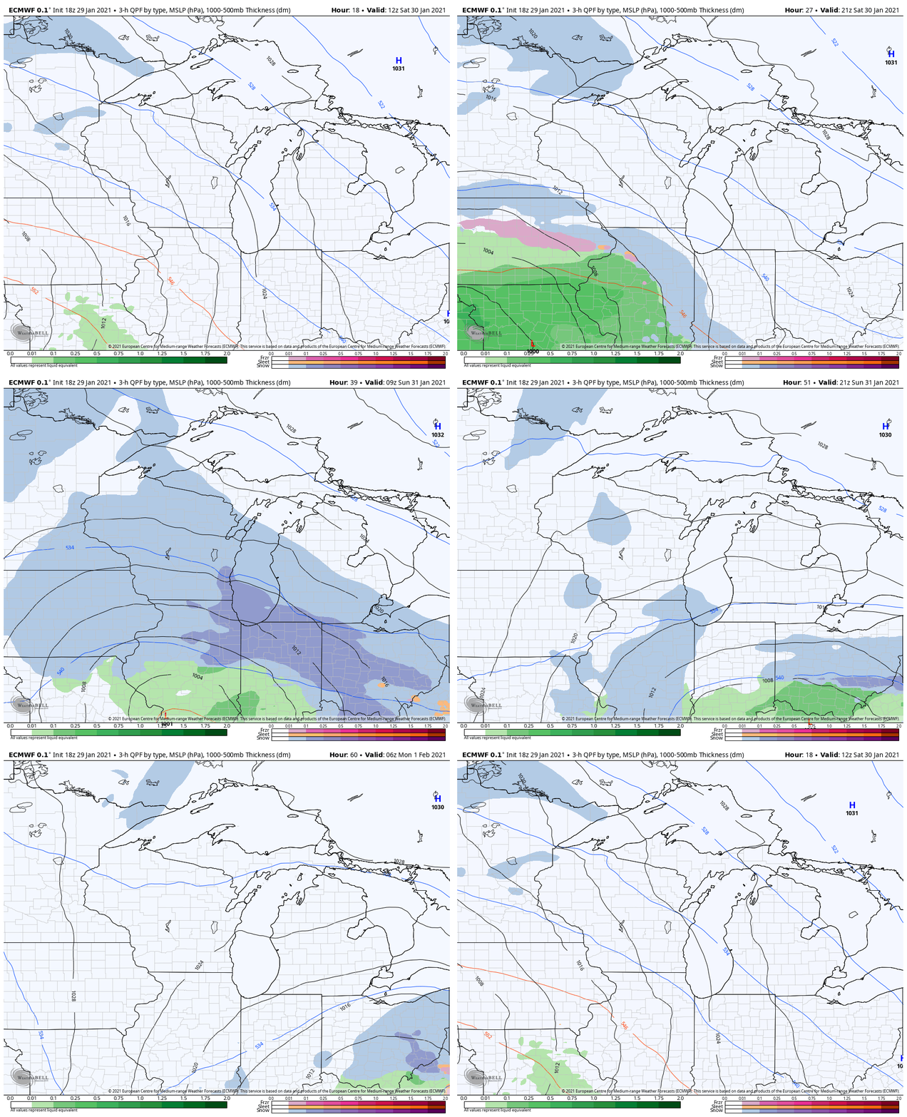
Here's another perspective of the snow and mix advancing across the area Saturday afternoon through early Sunday.

Anyway, I like what he 18z EURO is showing with the 4" or better amounts north of a line from near Iowa City to about Muscatine and on to Kewanee. The heaviest amounts 6-8 appear most likely from far EC Iowa into the northern third of Illinois, especially near and north of I-80. Hopefully, nothing moves from here on out. I will continue to monitor the trends in coming posts. Roll weather...TS


