MOTHER NATURE IN A GIVING MOOD...
- terryswails1
- Jan 28, 2021
- 3 min read
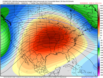
In the good book of weather it has been said, mother nature giveth and she taketh away. Currently she is in a giving mood when if comes to snow and that means another significant snowstorm appears to be on the way for much of my area Saturday. The energy is currently over the Pacific getting set to consolidate over the SW. From there is swings northeast and crosses the central Midwest as a closed 500mb circulation. You can see the process unfold in this animation.

One of the big things this system has going for it is moisture. The Gulf of Mexico will be open for business as you can see in the available water moisture (PWAT's) it has to work with. They are up around an inch all the way into Iowa which is tough to do in the dead of winter.

In fact, levels that high are about 300 percent of normal. Get the idea.

The other big issues we concern ourselves with in all winter storms is track and thermal parameters. So far, models have been very consistent tracking the surface low across Missouri into central Illinois. That's a good spot for my area to receive snow as we remain in the cold sector with an east/northeast wind component. Below you can visualize how the EURO tracks the low and precipitation shield through the Midwest.

Despite being in the cold sector, this disturbance won't be as cold as the previous one and so snow ratios will be lower closer to the traditional 10:1 average. In the far south, particularly south of I-80, a shallow layer of warm air may start the event with rain, sleet, or some sort of mix. However, evaporative cooling with the heavier rates of precipitation will eventually turn it over to snow. That should mean amounts in the south end up lower than in the central and north. The final track will be the determining factor in how much snow and where. It's too early to cut the lines just yet.
Having said that, I do have some early snowfall forecasts from several models. To be clear, this is just raw model output and thus the value in these mid-range depictions is to show existing trends with regards to amounts and location. This is what we as forecasters look at to make forecasts when the time comes. Again, these are at 10:1 ratios, other tools such as Cobb and Kuchera show somewhat higher amounts, especially north of HWY 30. Here's what I've got to show so far.
The EURO

To give you an idea of how bullish the EURO is on this system take a look at the odds it shows of an inch or more of snow. They are 90-100 percent over the majority of my area.

That's not much different than what it shows for 3 or more inches.

Finally, there's this. A healthy swath of 60-80 percent odds of 6 or more inches through the heart of my area.

The GFS is kind of funky. The operational was so off base with thermal profiles that it didn't even show accumulations south of HWY 20. I threw that out and went with the ensembles which were more in line with what I'm thinking. This is what they indicated.

The Canadian GEM

The SREF

The 12K NAM

As you can see, the evidence is strong that more snow is coming to the area at some point Saturday. Keep your shovels handy. especially near and north of I-80. More details on this storm and this very active pattern that currently exists in coming posts. Roll weather...TS
LIMITED COPIES LEFT:
A SECOND PRINTING OF MY NEW BOOK IS ON THE WAY...
250 NEW COPIES OF DERECHO 911, IOWA'S INLAND HURRICANE ARE AVAILABLE. Around Christmas we sold the last of the 1500 copies of our book on this historic thunderstorm, the most damaging in U.S. history. Due to continued demand we have ordered a limited number of 250 for those of you interested in having the most authoritative account of this extreme event. You can get yours at derechobook.com


Comments