


TURNING UP THE HEAT...
- Mar 12, 2022
- 2 min read
An Arctic front whistled its way through the Midwest Friday leaving us with an unwanted taste of January chill. Readings early Saturday are down in the range of 5-10 degrees. Even worse, wind chills have dipped well below zero! Not the way you want to start your Saturday.
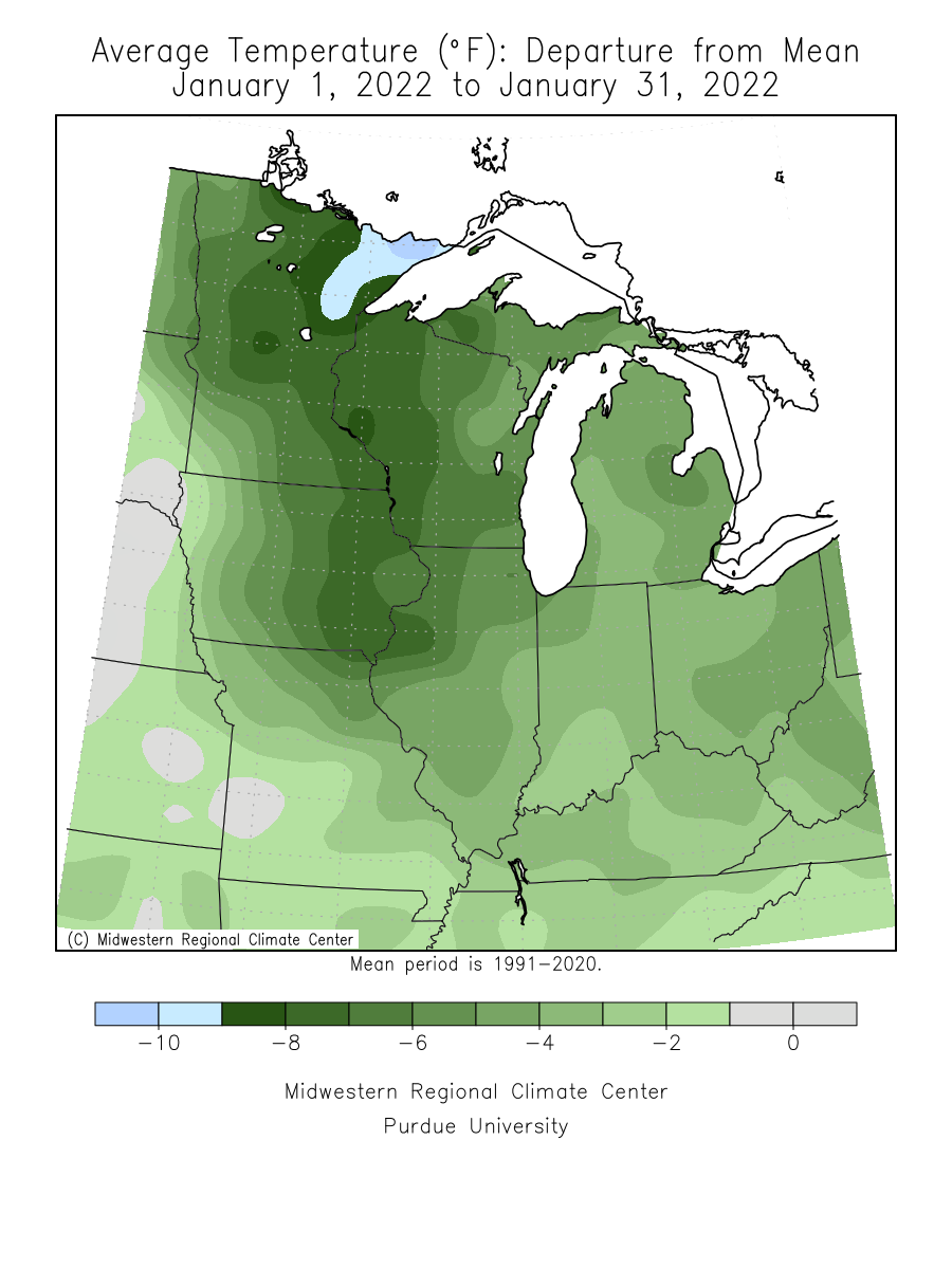
The cold is part of a trend that goes back to the first of the year. After a very mild December, winter finally found us at the end of the month. Despite some mild days, 2022 is running several degrees below normal. The year began frigid with January ending as a very cold month throughout the upper Mississippi River Valley.
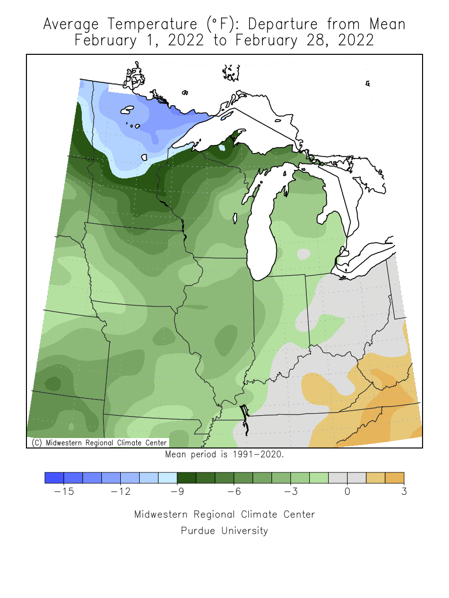
February was not as bad but still below normal over the entire Midwest.
To date, March is close to normal but the year as a whole is running 3-5 degrees below normal over my entire area.

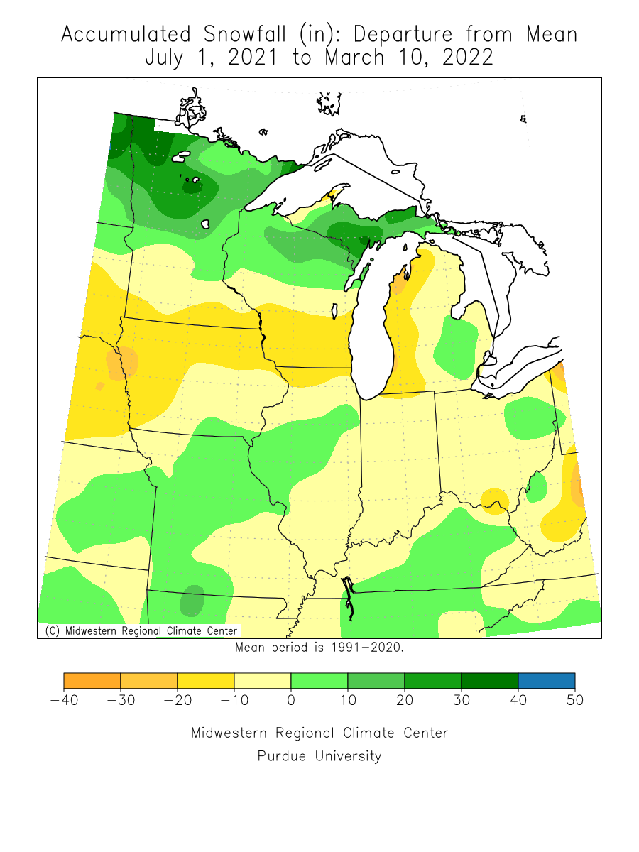
Despite the abundant cold, snowfall has been below normal this winter through most of Iowa and northern Illinois. The exception is my far southern counties where February was far more generous with snow there. In fact, more snow has fallen in parts of SE Iowa and central Illinois than parts of northern Iowa and southern Minnesota. You don't see that very often but the depth of the cold this winter has kept the active storm track over that part of the Midwest.
BETTER DAYS AHEAD...
One thing apparent in the mid-range forecast is that warmer days will soon be here again. After a cold Saturday with highs only in the 20s, the tide turns and up go the temperatures. You can see why in this comparison of upper air heights (500mb jet) and the resulting temperature departures.
Friday's 500mb jet

The resulting temperature departures Saturday morning.

Fast forward to Wednesday's 500 jet.

The resulting temperature departures Wednesday.

You can see how this results in an extended period of warmth with the EURO meteogram depicting readings that look like this through March 21st. After Saturday, highs the next 9 days are all in the 50s and 60s.

Here's the 7 day temperature departures for the period March 14-21st.

Along with the building warmth we should also enjoy the pleasure of dry weather. Little if any rain is expected with 7 day rainfall departures that look like this into Thursday. Hopefully some much needed precipitation works its way into the picture beyond that period.

With coats and gloves Saturday, we play the waiting game for those spring-like temperatures that are destined to be ours in a matter of a day. Rest assured, it will be worth the wait! Roll weather...TS
PLEASE CONSIDER SUPPORTING TSWAILS...

Hi everybody, I'm asking that those of you who find value in the site to consider a $12 dollar voluntary subscription covering operating expenses and the time and effort I put into the site. My $12 dollar asking fee is the cost of a pizza or a dozen donuts. Those are gone in a day, TSwails.com is here for you all year long. It's a heck of a value and all I'm asking is that if you enjoy the site and see value in it, that you please consider a voluntary subscription. I'm asking $12.00 dollars a year. That's $1 dollar a month or 3 cents a blog. Thank you for your support and consideration. Terry


Comments