


BIG SKY, EVEN BIGGER SNOW...
- Oct 2, 2019
- 2 min read

A historic winter storm impacted much of Montana "big sky country" from September 28th through September 30th. Many areas broke September snowfall records and minimum temperature records. Snow measured in feet along the Rocky Mountain Front and adjacent high plains, and near a foot or more in some areas across northern and central portions. Winds of 30-55 mph produced blizzard conditions in spots. In several locations, 24 hour record snows for any month of the year were established!

This picture was taken in Browning, MT. where 48 inches of wind blown snow piled up. Drifts to the roof top!

Another shot from Browning

This image was taken in Havre, MT.

This is the storm responsible for the summery conditions and thunderstorms here the past 24-48 hours. More heavy rains fell Tuesday but as expected did so in the NW half of my area, at least as of late Tuesday night. Some of this will have pushed further SE by daybreak Wednesday. These are the rainfall estimates as of 1:30 AM. Pretty close to 2" at my place in NE Cedar Rapids and it's still coming down. Several flash flood warnings were issued where 2-4" rains were indicated.

After a morning lull, scattered showers and storms are expected to re-develop Wednesday afternoon and evening as a wave moves along the slow moving cold front. This time the heaviest of this will be in the SE half of my area, especially SE of a line from Rockford, Illinois to Clinton and Washington, Iowa. Eventually the front will bring a noticeable drop in temperatures. These are the 5 day departures Thursday through Monday of next week.Much of my area is expected to be about 2-4 degrees below normal...far from those 80s to near 90 degree readings of the past 2 days.

The next rain maker is still on track for later Friday night and Saturday. This system won't have the strength of the one that's with us now but it does appear to have enough punch to produce moderate rains in much of the region. The EURO show this for totals.

The GFS has this. A bit more bullish.

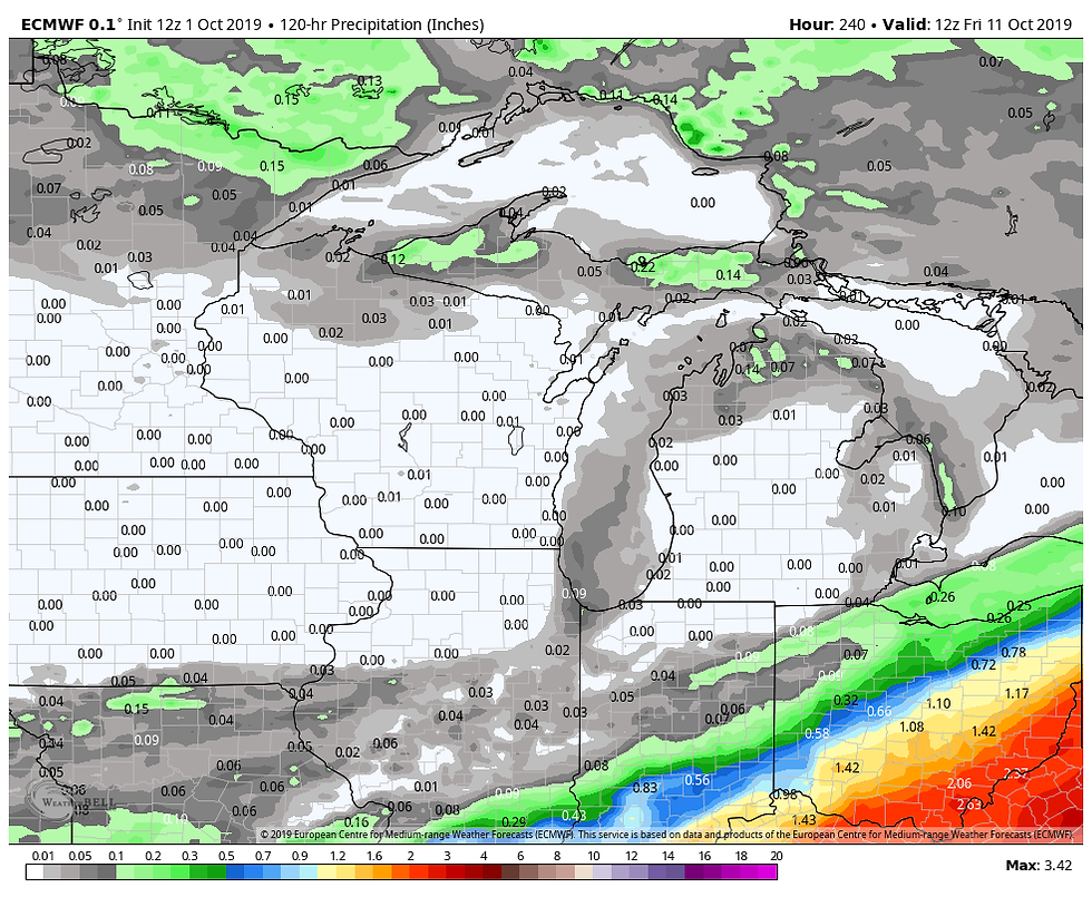
Clearly we need a break from the wet weather and we should get that next week. This is the total rainfall on the EURO Sunday morning the 6th to Friday morning the 11th. Nice to see some zeros on the board.
I do think the cooler drier weather is just a short term anomaly. I'll tell you why in my next post tomorrow. Until then, roll weather...TS


Comments