LET'S GET THIS PARTY STARTED
- Apr 13, 2024
- 4 min read
THE RISING...
Howling winds blistered the region Friday in the wake of our most recent storm. Swirling gusts of 35mph were common, which brought 850 temperatures (5,000 ft.) below freezing. However, the strong mid-April sunshine did its thing, allowing highs at the surface to get back in the range of 59-64. At this time the cool air is beating a hasty retreat and significant warming is set to move in for the weekend. The rising is here. Let's get this party started.
TERRY'S 5-STAR AIRBNB, WHERE VACATIONS ARE HEAVENLY (MAKE IT YOURS)
TSWAILS.COM, THE GUY DOES WEATHER RIGHT
HOW HIGH DO WE CLIMB?
If there's one new trend that's consistently shown up on modeling the past 24 hours, It's that temperatures (while still well above normal), have come down about 4 degrees from where they were a couple of days ago. The primary reason for this is a somewhat stronger reflection of cold dense air in southeast Canada. It allows a back door cool front to sink into southern Iowa Sunday. Instead of southwest winds like we see Saturday, winds become more E/SE Sunday and Monday. The warmth will have to buck a bit more of that cooler air coming north. That may keep most of us from hitting 80, although it will be close in the south. For the period Saturday through Tuesday, guidance is now suggesting low to mid 70s north, to mid and upper 70s south. A slight reduction looks to be in order.
For certain, the weekend is going to be a beauty, with highs Saturday 70 north to 76 south. Sunday should be a hair warmer, with the range at 72-78. Mostly sunny skies and dry weather will be the end result. A keeper for sure!
Monday the area comes under the influence of a deepening storm that threatens to bring a severe weather concern, perhaps as early as Monday night but more likely Tuesday. In advance of the storms, highs Monday should remain in that 72-78 category, with a couple spots in the far south pushing 80.
While temperatures are mild through Monday, moisture remains scant until later Monday night, when we begin to feel the effects of the incoming storm. Warm advection kicks in as the low level jet increases after sunset. This provides the forcing necessary to fire nocturnal thunderstorms. Due to the deeper push of cool air, it now appears to me that the south now has a better chance of seeing these storms. The north may remain dry and rain free Monday night. Any storms that develop in the south are expected to be elevated, which keeps the primary severe weather threat of hail, lightning, and heavy rain confined to the stronger updrafts near a warm front inching into southern Iowa.
Tuesday is the day to watch for a more widespread severe weather episode. It may be that Monday night's convection limits the northward advance of the warm front, creating a fairly strong thermal gradient north of I-80. The position of the warm front is critical because winds will be backed along it, generating significant 0-6km shear. With proper destabilization, that would be the area to watch for any tornado threat. The arrival of the cold front towards evening is also likely to generate some strong storms, but shear is likely to be less by then, which in theory would favor hail and wind, with a lower tornado threat.
As of late Friday evening, SPC has all of my region included in a day 5, (15 percent risk area). That means a 30 percent chance of severe weather within 25 miles of any given point.

I do think it's important to stress that we are still more than 72 hours away from the event and while there are large scale signs pointing to severe weather potential, there are still many mesoscale details that are unknown. If just one ingredient is missing, such as instability, a CAP, less shear, timing, etc., the whole set-up can fall apart in a hurry. The point of the exercise now is getting the word out early so if the threat is realized, people are aware and prepared. If we need to stand down as the event nears, that is a good thing. No harm, no foul. Honestly, I'm somewhat conflicted, as there are more negative signs for severe weather tonight than 24 hours ago. We'll see where trends lead us later Saturday.
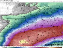
Here's what the EURO and GFS suggest for rainfall Monday night through next Wednesday.
The EURO

The GFS

Following what will be a warm, potentially stormy, and rather muggy day Tuesday, much colder air appears destined to enter the picture late next week and the following weekend. The EURO at 500mb shows an anomalous pocket of cold air diving into the middle of the nation next Thursday.

The following day, Friday the 19th, it indicates temperature departures 18–20 degrees below normal. That's a bummer!

While there is some uncertainty about details with storms Monday night and Tuesday, there is little doubt the weekend ahead is going to be a nice one. Make your plans accordingly and enjoy. Roll weather...TS


Comments